


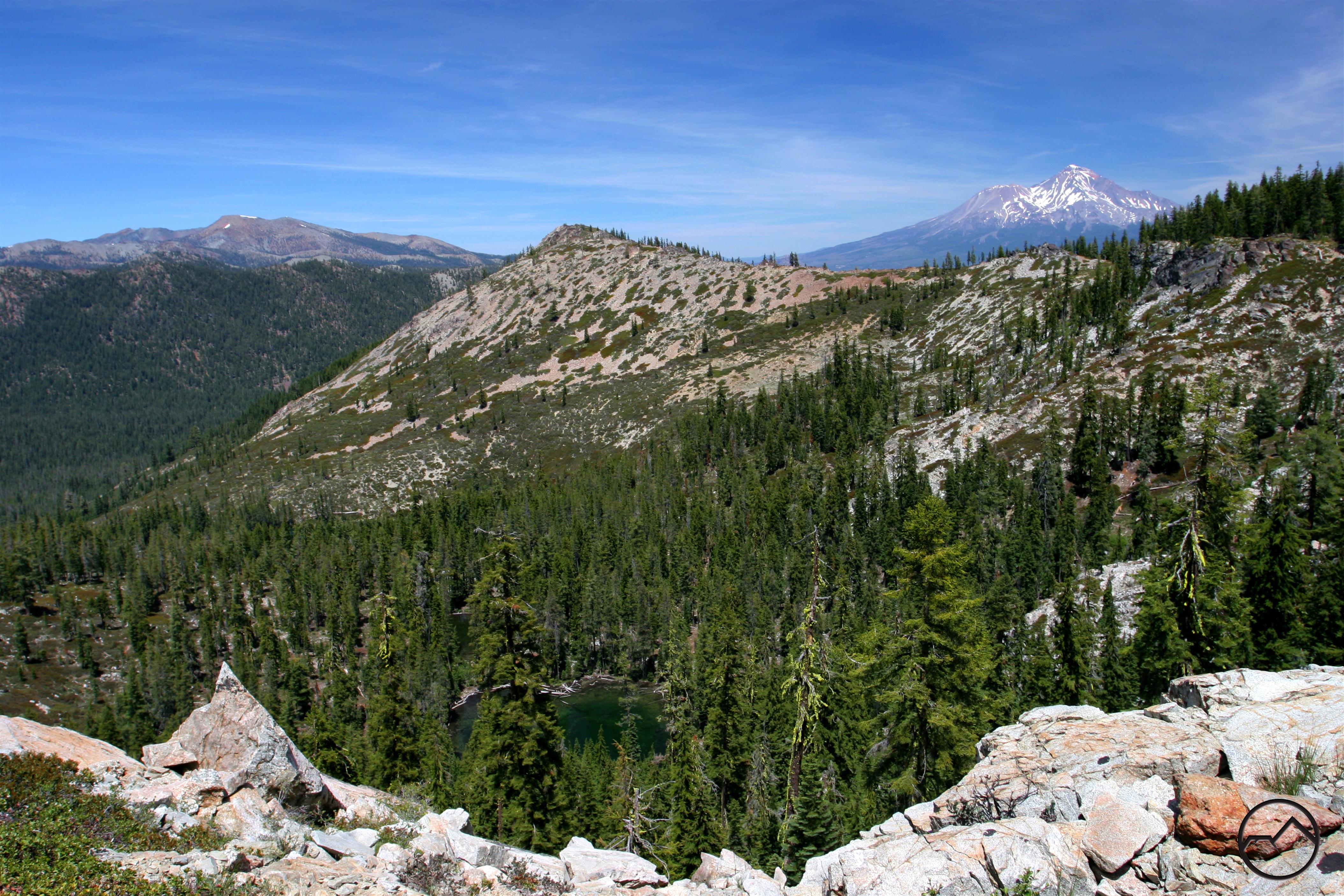
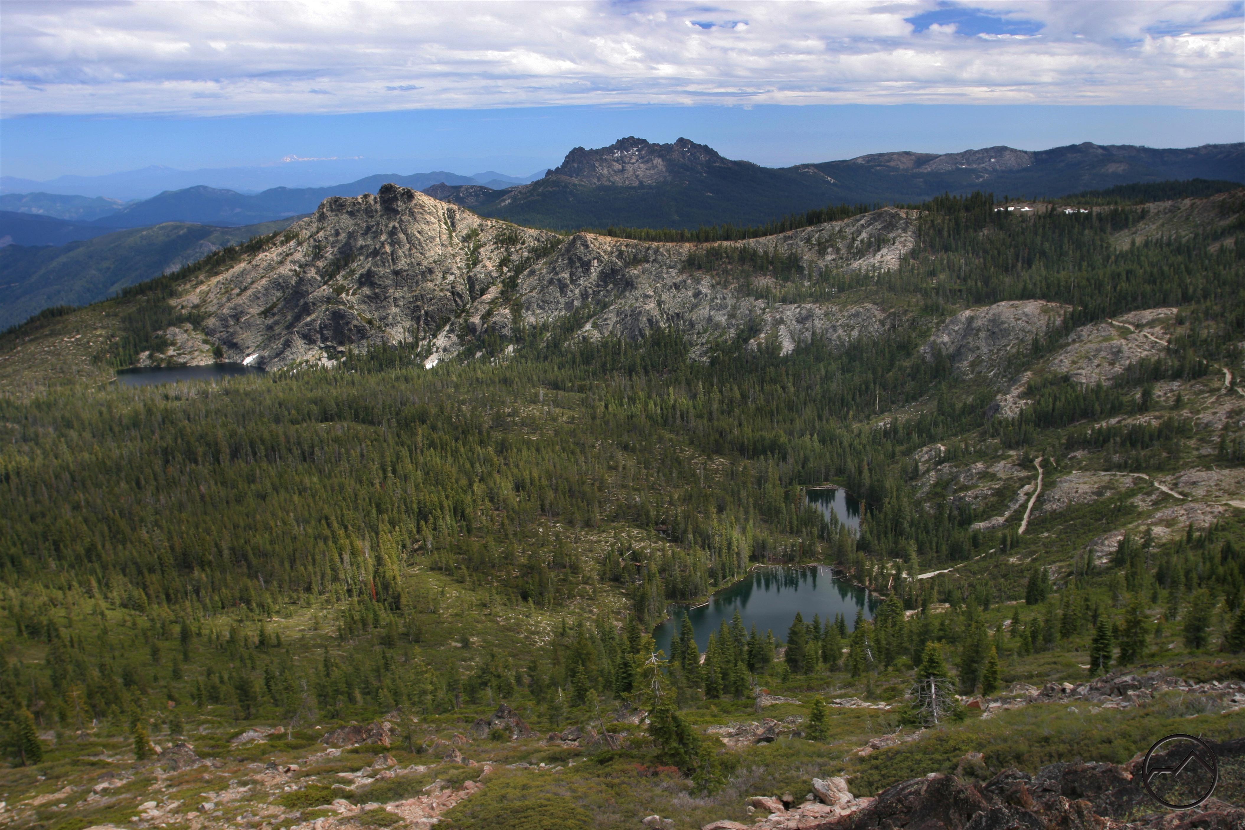
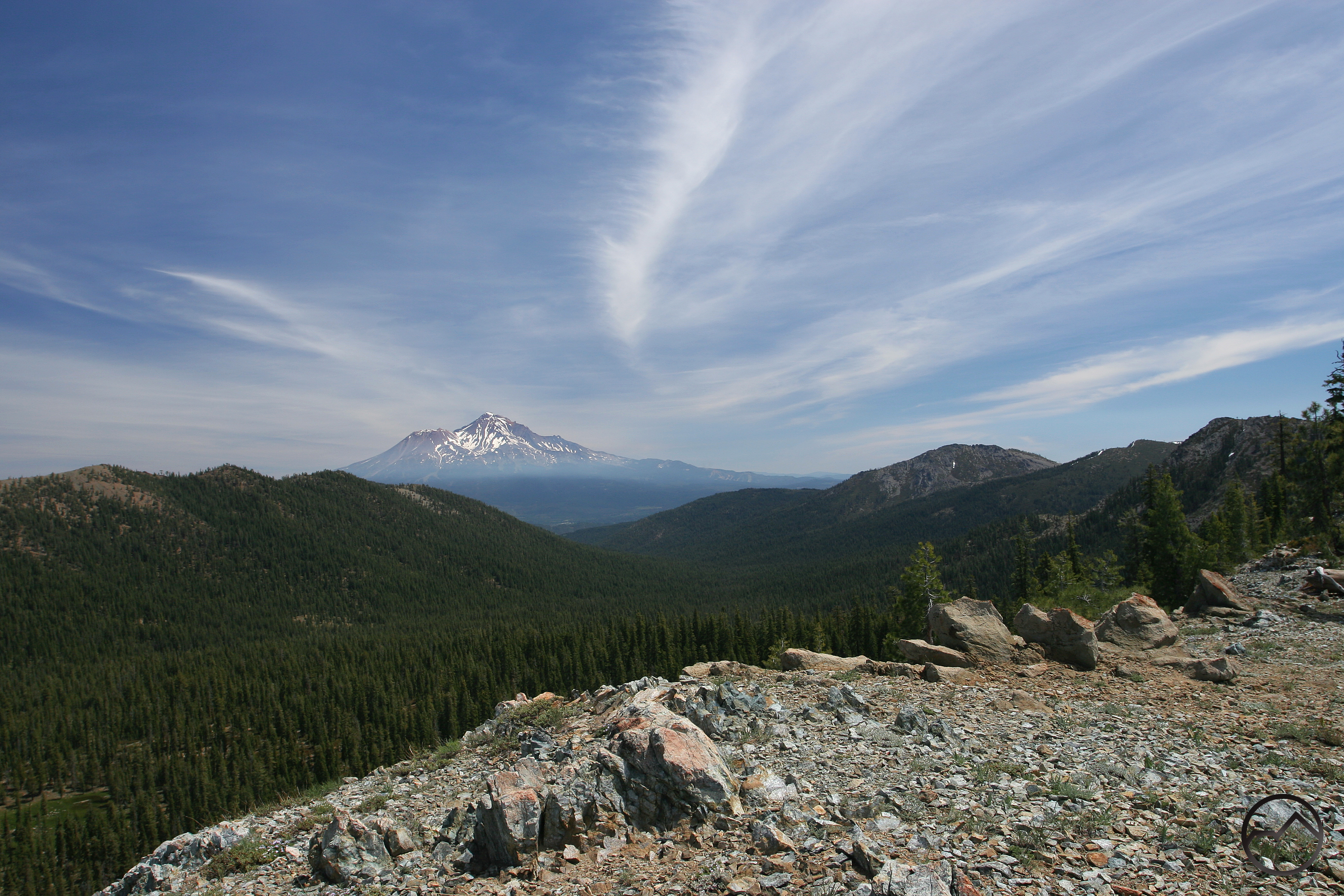
Pacific Crest Trail from Parks Creek Trailhead
Pacific Crest Trail from Parks Creek Trailhead can be reached from a paved road about 30 miles from Mt. Shasta Ranger Station. Going south on the Pacific Crest Trail, there is level 2 mile section of trail to Deadfall Lakes and the intersection of the Sisson-Callahan National Recreation Trail. It is 6 miles along the crest of the Trinity Divide.
Category: Medium
Distance: 6 miles
Elevation Gain: 475 feet
Route Type: Out and Back
Directions: Take Stewart Springs exit off of Interstate 5 just north of Weed, Calif. Go west on Highway 97 towards Gazelle for 0.2 mile. Take a left on Stewart Springs Road, continue for four miles and take a right on Route 17. Follow Route 17 for 9.3 miles to the top of Parks Creek Summit and the intersection with the PCT. There is a large parking area on the east side of the road.
Highlights: Part of the famous Pacific Crest Trail, stunning views of the lake basin
Photo Credit: Hike Mt. Shasta – Trinity Divide Trails – Seven Lakes Basin Via Pacific Crest Trail (Bubba Suess)
