


Clear Creek Trail
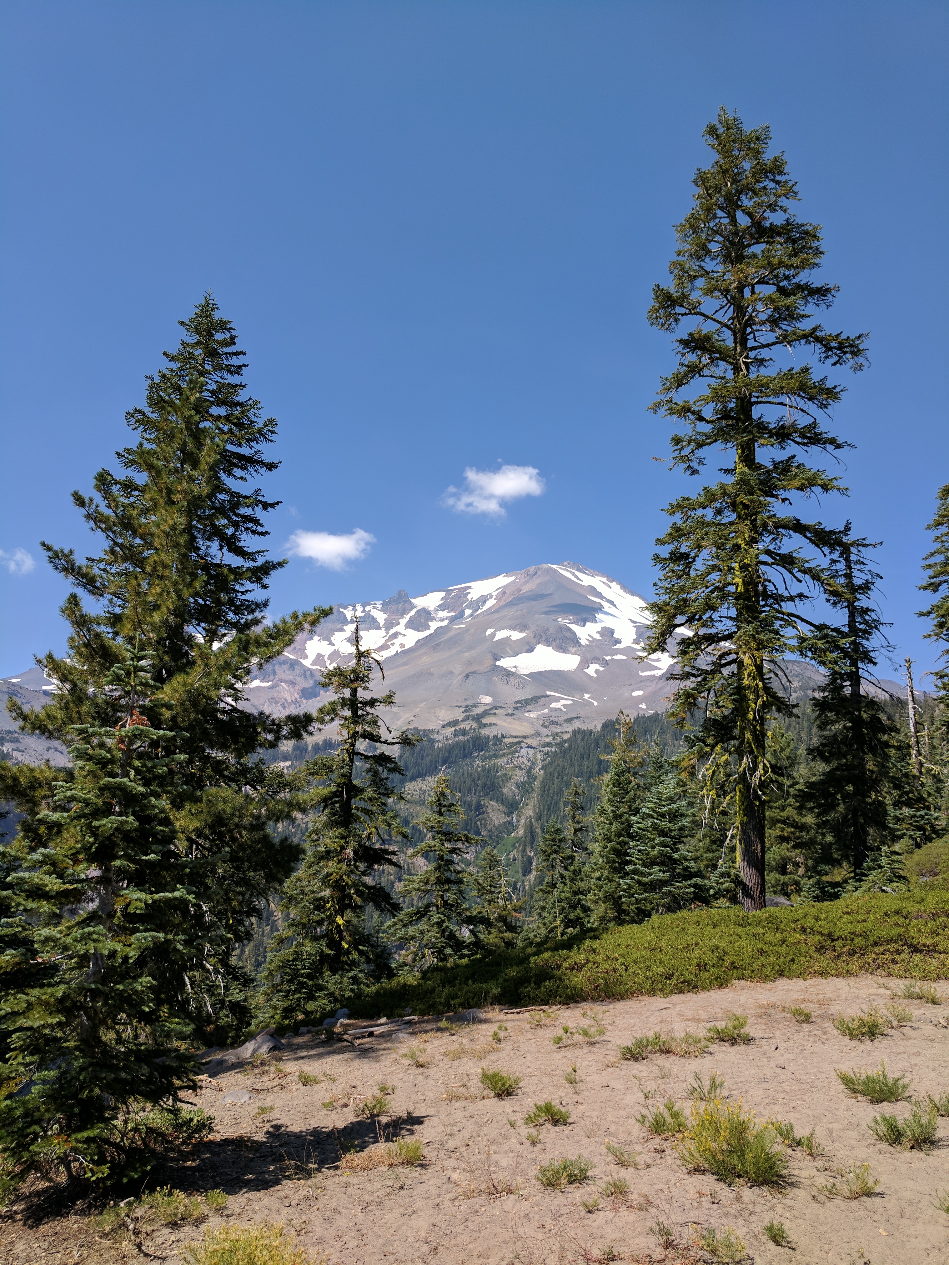
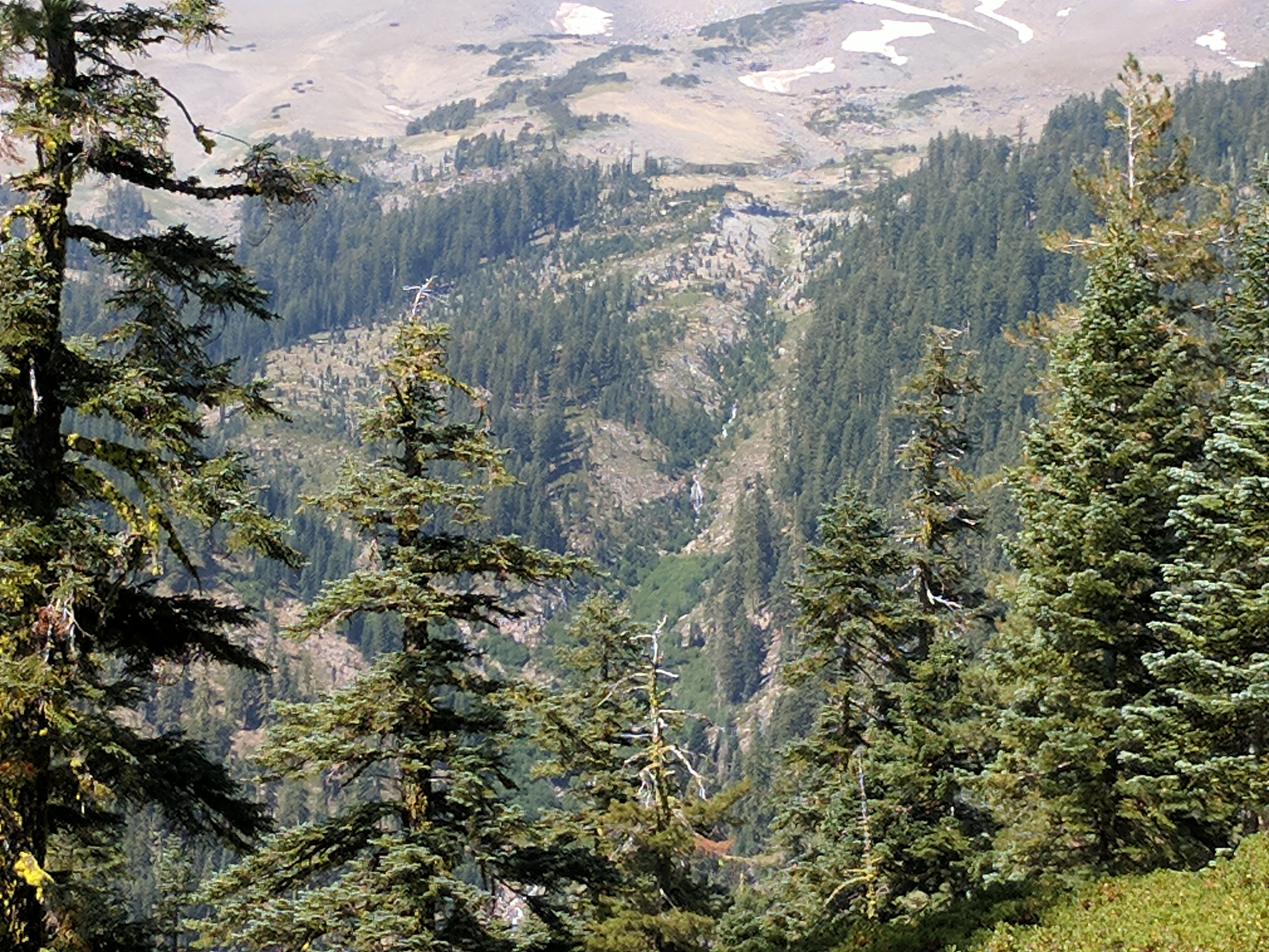
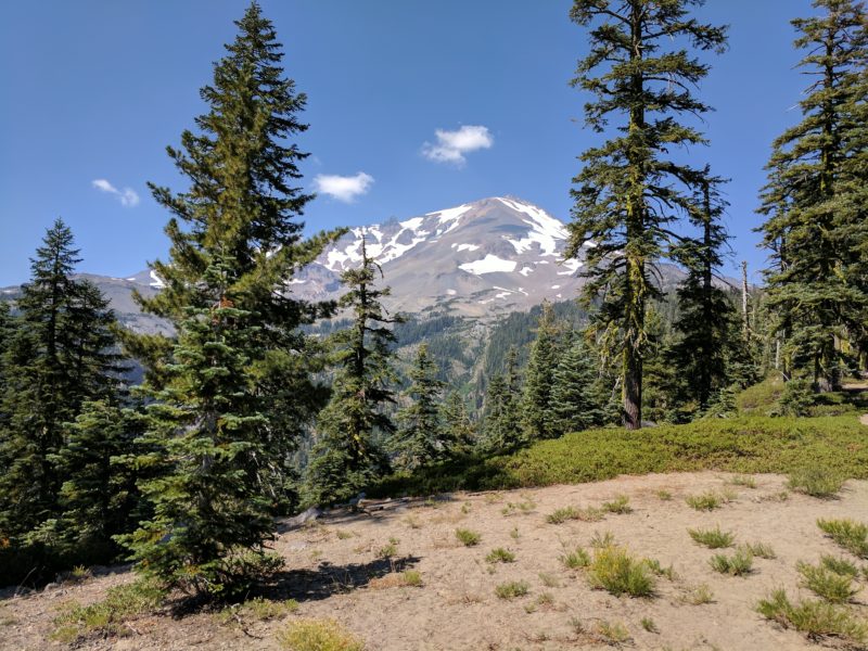
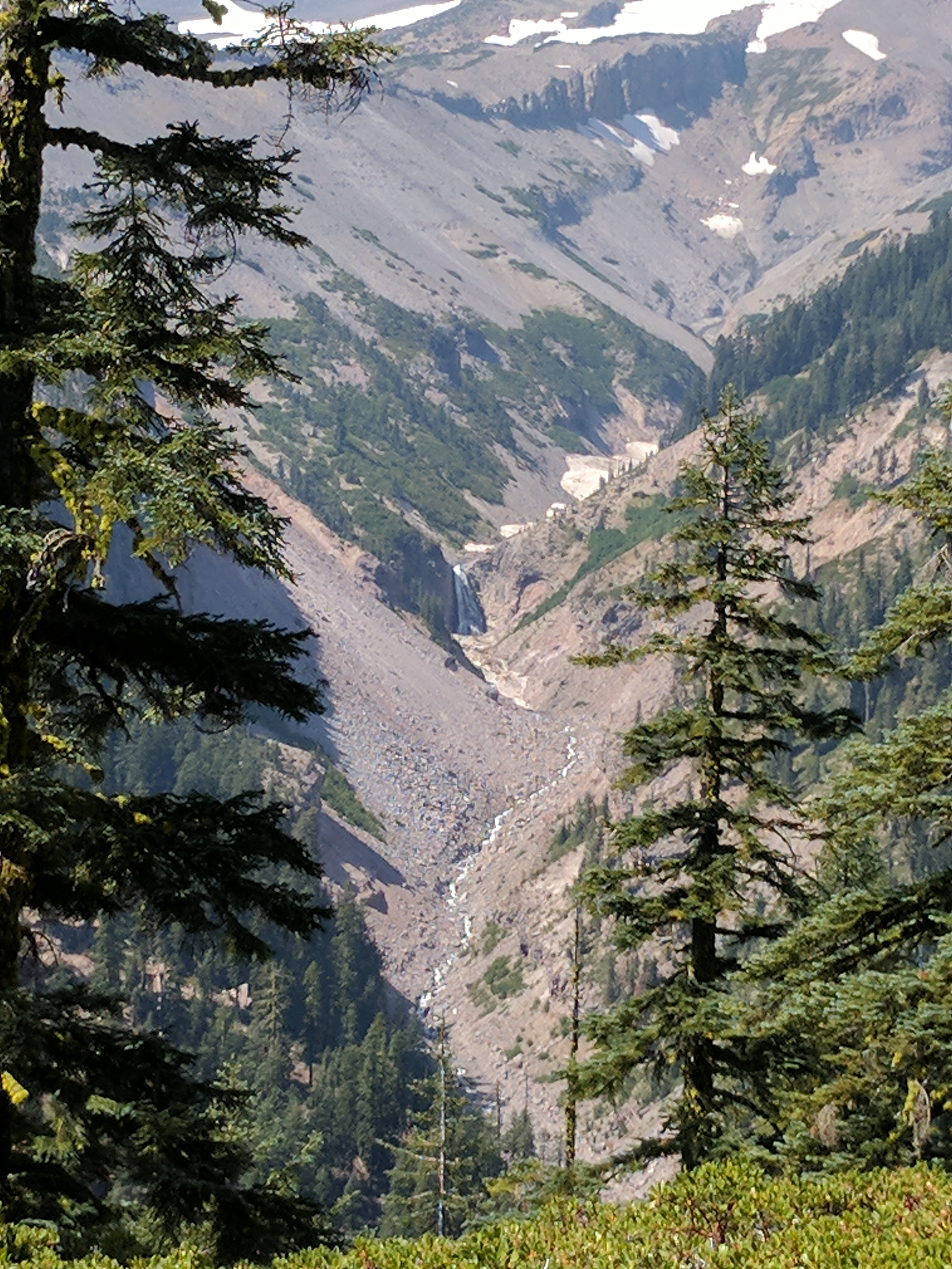
On the southwest face of Mount Shasta is where you will find Clear Creek, the main route. This route has an easier slope than Avalanche Gulch and has amazing views, beautiful alpine meadows, deep Mud Creek Canyon, and is a lot less populated than many other routes that come from Bunny Flat. People climb Clear Creek in all conditions depending on preference. The route may have full snow coverage from the trailhead to trails, it depends how late into the season you are. As the season nears the end you can find running water at the Clear Creek Meadows and there are many camp locations ranging from 8300 feet to more than 9900 feet on the route.
Please note that the road leading up to the hike is rocky, a 4-wheel drive vehicle is recommended to access the trail.
Category: Medium
Distance: 5.7 miles
Elevation Gain: 1,994 feet
Route Type: Out & Back
Directions: From 1-5 N, take exit 736 to merge onto CA-89 S/Volcanic Legacy Scenic Byway toward McCloud. Turn left onto Pilgrim Creek Rd after 3.2 miles. From there, turn left onto Wintoon Way, then turn right onto Hotlum Drive. Turn right onto Widow Springs Drive then turn left onto Snowline Circle. Snowline Circle turns left and becomes Summit View Drive. Turn right onto Lakeview Drive, then turn left onto Widow Springs Drive.
Highlights: Beautiful waterfall, gorgeous views of Mt. Shasta
Photo Credit: Discover Siskiyou
