


No matter what your ability or activity level, hiking in Siskiyou is something that can be enjoyed by anyone. If you are new to hiking, looking for accessible adventures, have little ones in tow, or you are just looking for a shorter day-hike, this is the destination for you. Siskiyou is home to many miles of easy and epic trails that do not disappoint when it comes to rewarding views and sense of accomplishment. Immerse yourself in nature with our list of fulfilling hikes for beginners and still have a bit of time in the day, and energy for more epic adventures.

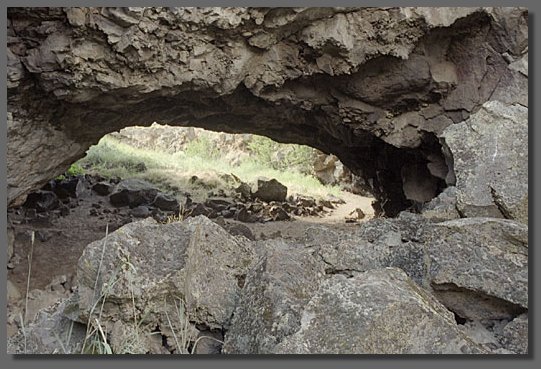

Pluto’s Cave Trail
A high-desert and volcanic hiking experience in the Shasta Valley to an ancient lava tube that extends over a mile underground. Total hike above ground is 1 mile and if you hike through the cave, you end up completing a total of 3 miles. The trail winds through a high-desert landscape of juniper and volcanic rocky terrain 0.25 miles to the entrance of Pluto’s Cave. The trail is accessed off of County Road A-12 which can be accesses off of Hwy 97 out of Weed. There are signs 3.2 miles north of the 97/ A-12 cut-off directing you to the parking area and trailhead.
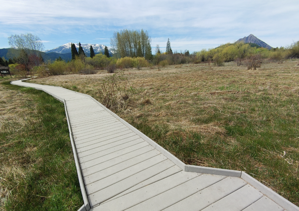
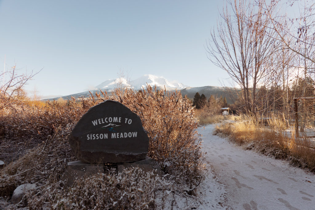
Sisson Meadow Trail Loop
This loop trail is 0.9 miles in total and only sees an elevation gain of 39 feet making it perfect for wheelchairs, strollers or folks with mobility issues wanting to get outdoors and cover some ground. The trail takes about 18 minutes to complete and is made up of paved asphalt, concrete and boardwalk sections that is mostly 3 feet wide throughout. The trail can be accessed on Lake or Alder St. in Mount Shasta. Enjoy the 360 views, wildlife and meadows that lie right within the city limits. Open year round!
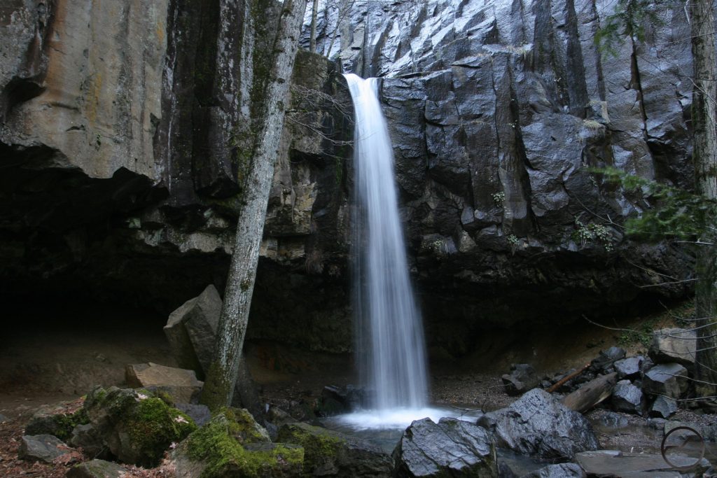
Hedge Creek Falls
With parking right off the I-5 in Dunsmuir, and a total round trip of under a half mile, this is the most rewarding hikes in all of Siskiyou. After exiting I-5 South at exit 732 on the West side of the freeway, look for the parking area, gazebo, and drinking fountain. The hike is fairly steep, takes about 20 minutes and has a few switchbacks. End your adventure a majestic 20 feet tall waterfall that plunges into an inviting pool below or follow the trail as it directs you to walk behind the falls and along Hedge Creek, eventually arriving at an observation deck above the Sacramento River.
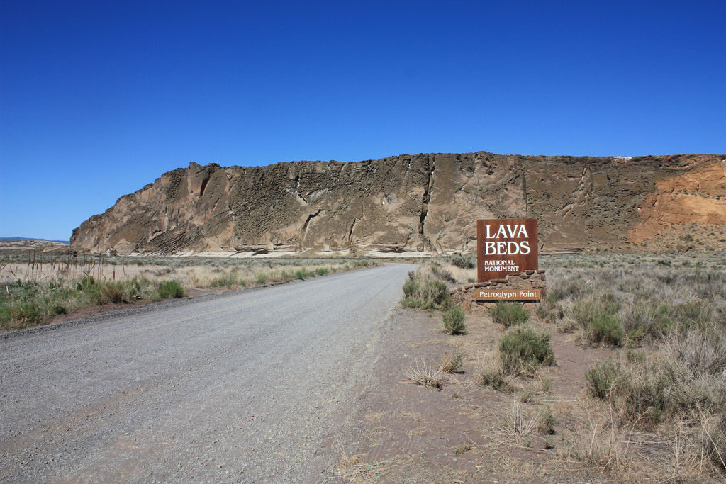
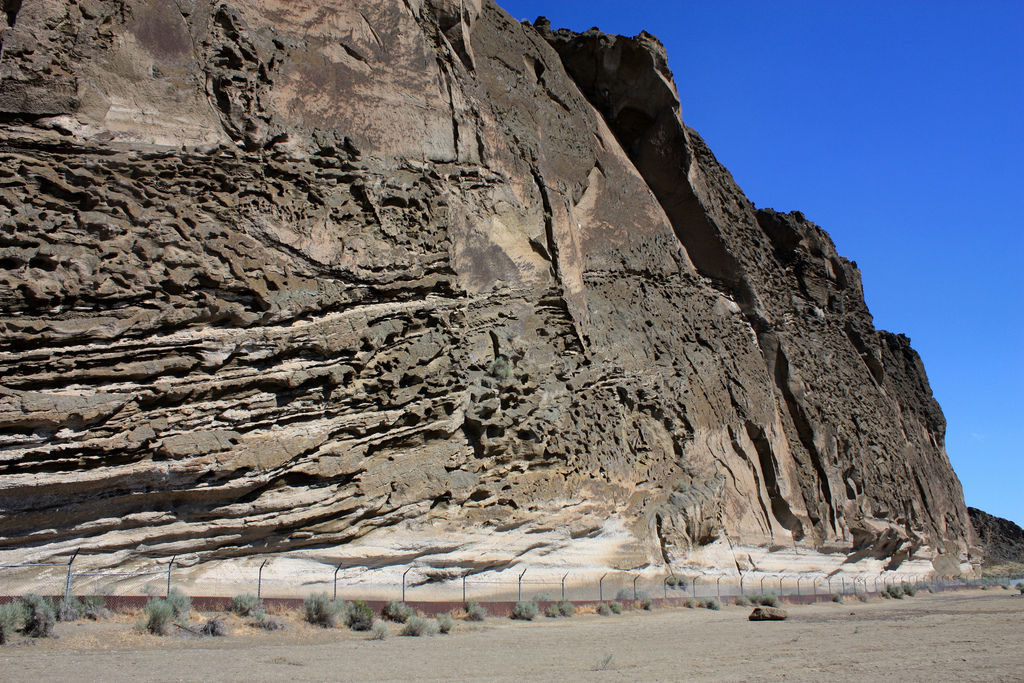
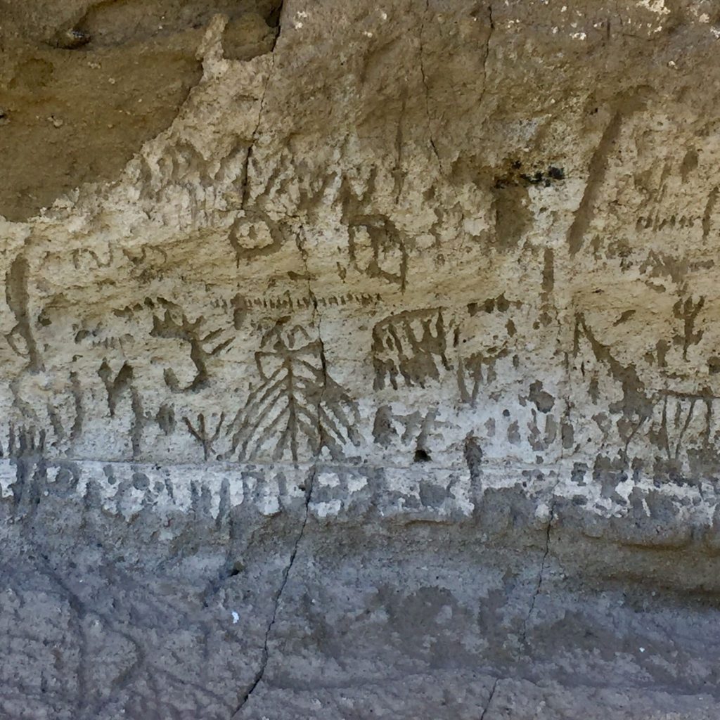
Petroglyph Point Trail
This out-and-back trail near Tulelake in East Siskiyou, is 0.8 miles total and takes an average of 27 minutes to complete. Within Lava Beds National Monument, and nearby the Tulelake Wildlife Refuge, sits this wall of stone with 6,500-year-old petroglyphs which is rock art from ancient people. Hike to the summit to enjoy vies of the Medicine Lake Volano and surrounding landscapes. The entrance to the trail is marked and you can get there by travelling North on County Rd 111, and East on 126.
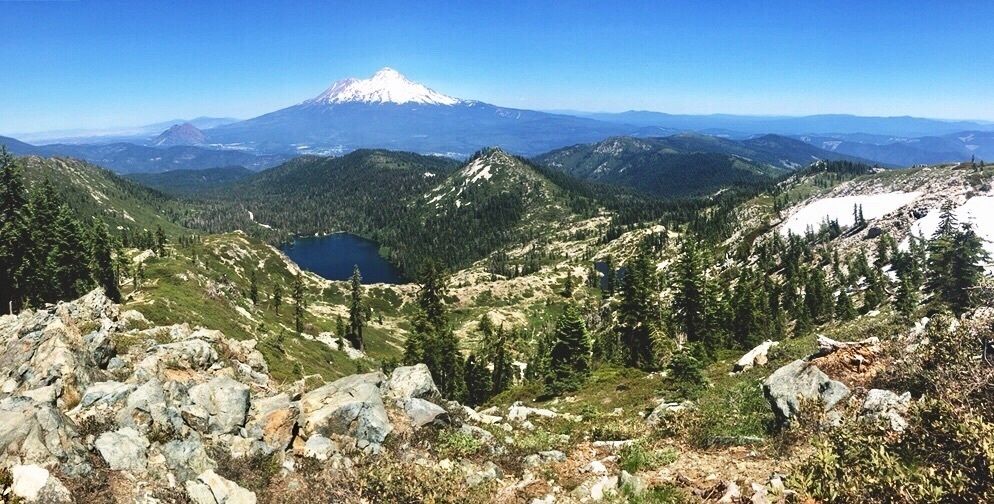
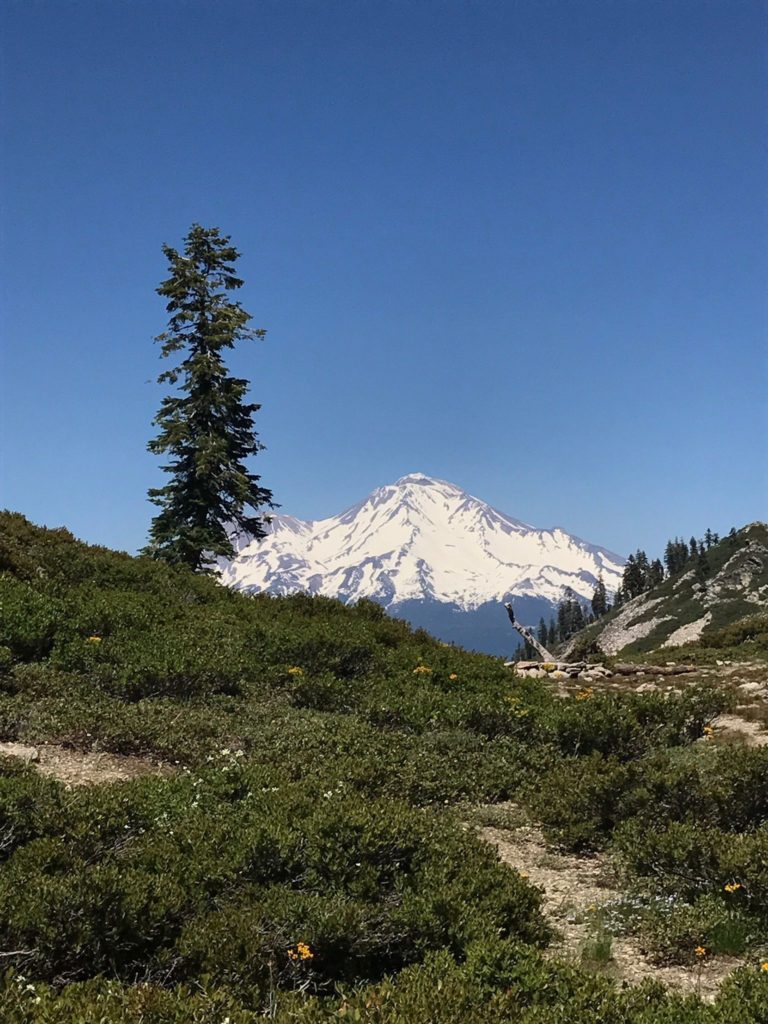
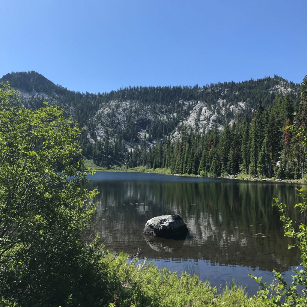
Castle Lake to Heart Lake
Large rewards for modest effort is the term that the Mt Shasta Trails Association uses to describe this hike. To get here, drive 10 miles Southwest of Mt Shasta City to the Castle Lake Parking area. The total round trip is 2.2 miles from Castle Lake. Enjoy meadows, wildflowers and epic views of Mount Shasta, Black Butte and the Eddys along the way to scenic Heart Lake. This is another hike that sees snow in the winter months, so check with the Shasta Trinity National Forest about access if you are hiking outside of the summer months.
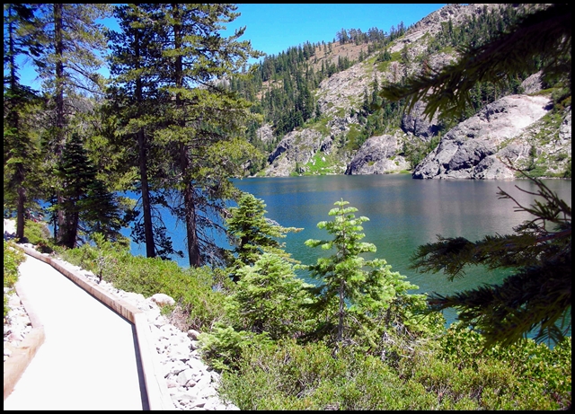
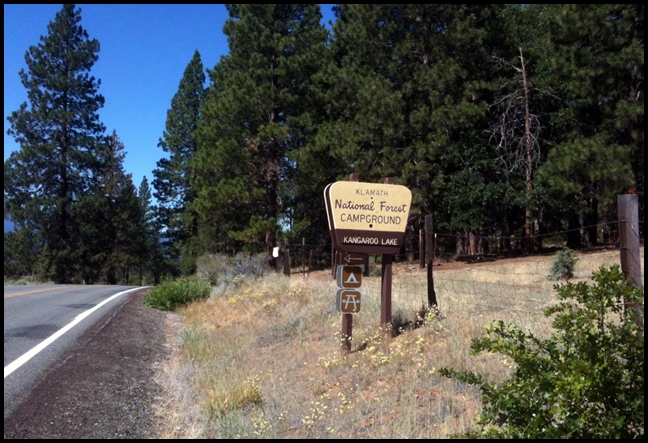
Kangaroo Lake Trail
Kangaroo Lake is one of the more popular mountain lakes in Siskiyou. This is partially because it is so accessible. The hike from the parking lot to the lake is just 1/4 mile and leads you right down a paved trail to the lake, which makes it perfect for wheelchairs, strollers, or towing a wagon. Continue on for the 1.1 mile out-and-back easy route along the water’s edge. Onsite camping is available for a fee, and this is a popular place for fishing for rainbow trout, non-motorized boating and swimming. The Kangaroo Lake Trailhead is about 10 miles from Callahan, turn on to Rail Creek Road and continue to the parking area. There are numerous hiking trails in the Kangaroo Lake Botanical Area. This location gets snowed in during winter months so check status before venturing out.
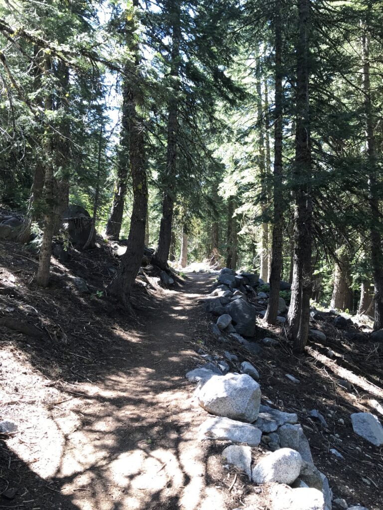
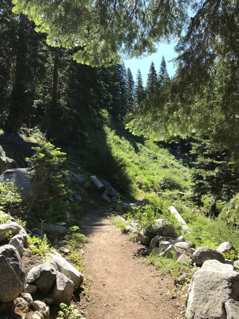
Hidden Lake Trail
This short, easy trail in the Trinity Alps Wilderness leads to a small but scenic lake. Total distance out and back is 2 miles and gains only 500 feet in elevation. Get to the trailhead via Callahan heading towards Carter Meadows Summit Trailhead on Callahan-Cecilville Road, also named Forest Hwy 93. This 3-acre lake is the headwaters of the East and South Fork of the Salmon River and is backed by craggy cliffs at the southern end. This is a great spot for wildflower viewing. The area can be snowed during the off-season in and is best attempted in the summer months.
Tips to Be a Responsible Hiker
Being a responsible hiker helps protect nature, ensures your safety, and shows respect for others on the trail. Follow these guidelines below and consider taking the Wander Pledge to join us in our commitment to preserving the beauty of nature.
- Plan Ahead: checking weather, trail conditions and bring along proper essentials
- Stay on Marked Trails and yield to uphill traffic
- Respect Wildlife, never feed animals, and observe from a distance!
- Pack out All Trash and Leave No Trace, take only photos and memories back with you!
