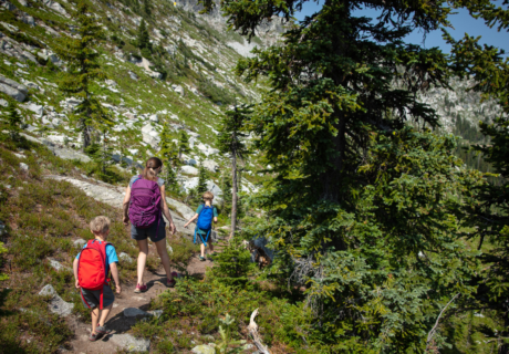
The Castle Lake Shore Trail begins through brush and rocks as it goes around a little part of the lake. The trailhead is at the north end of the parking […]
You can get to Horsetail falls by car to admire the marble-white cascade and see a much smaller cascade a half a mile north, Ponytail Falls. If you want to […]
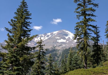
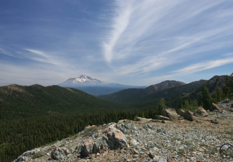
On the southwest face of Mount Shasta is where you will find Clear Creek, the main route. This route has an easier slope than Avalanche Gulch and has amazing views, […]
Two towns in California, Burney and McCloud, will be linked by the Great Shasta Rail Trail when done, along an 80-mile scenic trail. Along this trail the culture, local heritage, nature and the […]
To get to the trailhead the “upper” and “lower” Sand Flat Road can be used. The same routes can be accessed as the Bunny Flat trailhead using the Sand Flat […]
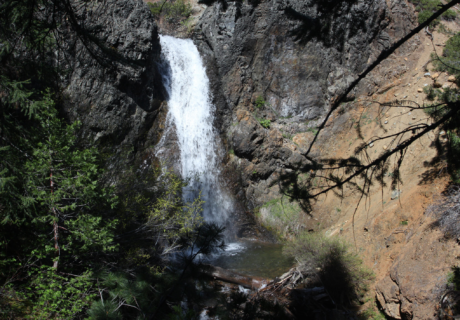
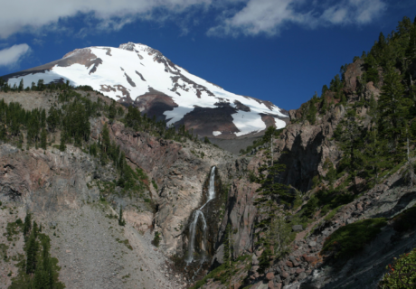
The Whitney Falls Trail is a hiking trail that leads to an overlook of Whitney Falls. There are four waterfalls on Mount Shasta, this being one. The Whitney Falls Trail […]
Driving to Bunny Flat is still easy, despite the closing of the Everett Memorial Highway. You can hike the Green Butte Ridge Trail or the path to Horse Camp. Right now […]
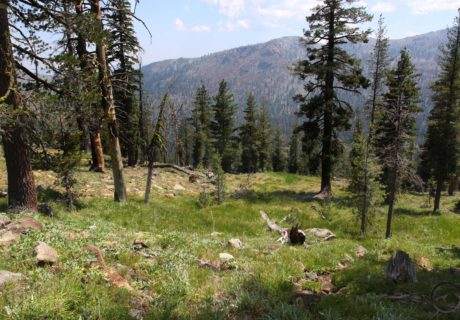
Gray Butte Trail is a moderate 3.5 mile round trip out of Panther Meadows that passes a sacred Native American site and old-growth forest on the way to an expansive […]
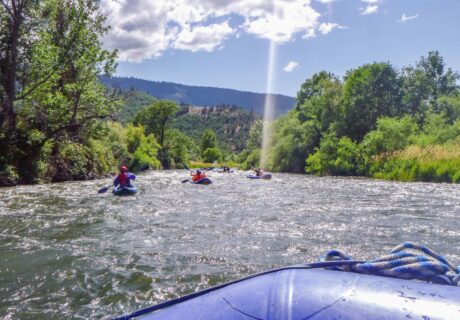
We are a fun, locally owned and operated company in Northern California offering whitewater rafting trips on the Upper Sacramento, Klamath, Trinity, and Cal-Salmon Rivers. We are small enough to […]
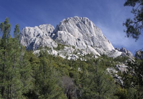
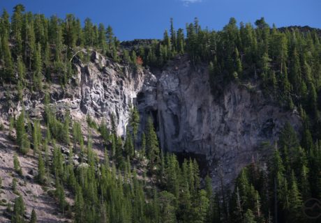
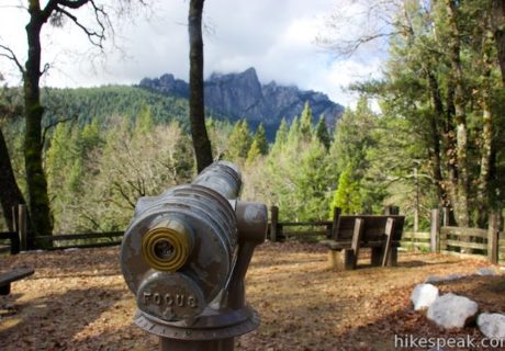
The Castle Crags are a very difficult area to see due to no trails going into the spire covered heart of granite making the viewing difficult. There are some trails […]
A Small Company with Big Goals – to create world-class outdoor experiences. Our Guides and Staff – one of the most experienced guide staffs in the world. Our Style – a mix of service, relaxation, excitement, […]
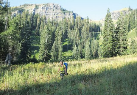
The most interesting trail on Mount Shasta is the Squaw/South Gate Meadow Trail. There are not many developed trails on the mountain which is surprising based off of the size. Most trails follow old […]
Just west of the Scott River on Kelsey Creek you pick up the Kelsey National Recreation Trail. Today the trail serves as a popular day hike to Paradise Lake and […]
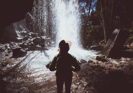
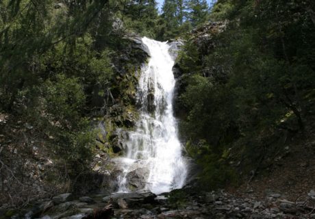
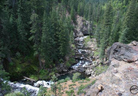
North of Redding in Dunsmuir there is a waterfall called the Hedge Creeks Falls. Hedge Creek runs off into the Sacramento River and is very popular due to its close proximity to I-5 making it a ideal stopping […]
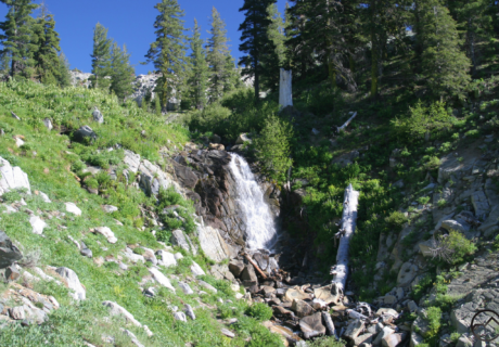
One of the least known waterfalls in the Mount Shasta area is Wagon Creek Falls. It is not thought about much, it gets lost amongst all the other beautiful waterfalls. […]
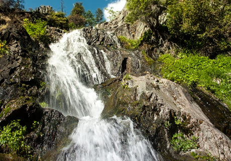
Root Creek Falls is a large, multi-tiered waterfall that spills 500+ feet over the granite Castle Dome just south of Dunsmuir in the Castle Crags wilderness area.
Castle Lake trail is one of the longer hikes in the greater Mount Shasta area encompassing 11 miles round trip, and is so worth it due to the amount of lakes and […]
Up the side of the Goosenest is the Goosenest Trail. It is a short but very steep hike up the side of a volcano with a large crater. It is an outstanding view of […]
The Shasta Valley Wildlife Area contains approximately 4,700 acres of Great Basin juniper woodland, riparian forest, seasonal wetlands, and crop lands, with Mt. Shasta as a backdrop.
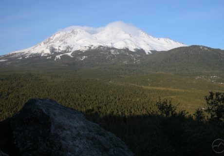
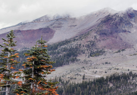
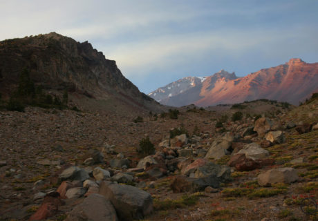
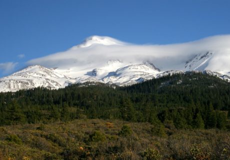
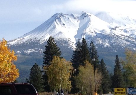
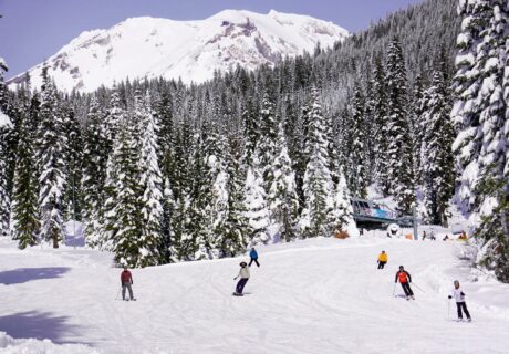
Mount Shasta Ski Bowl opened in 1958 and in 1978 an avalanche took out the lifts leaving it no longer operating, but it is still an amazing place to visit. […]
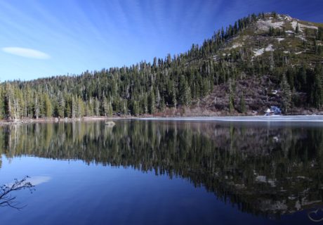
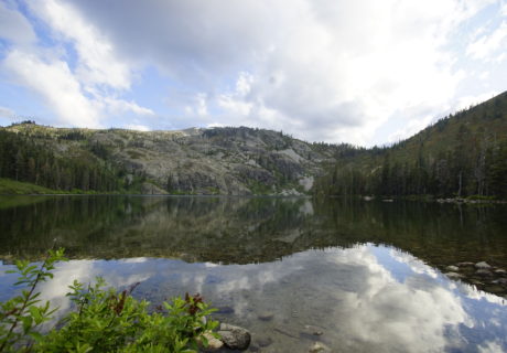
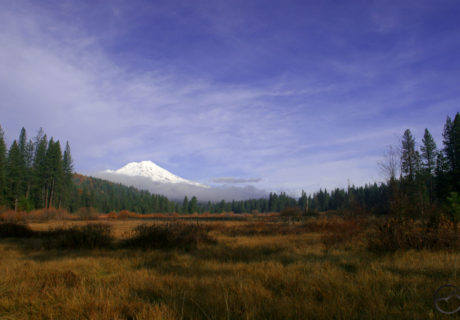
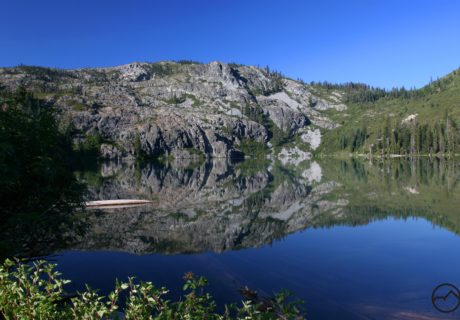
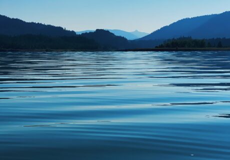
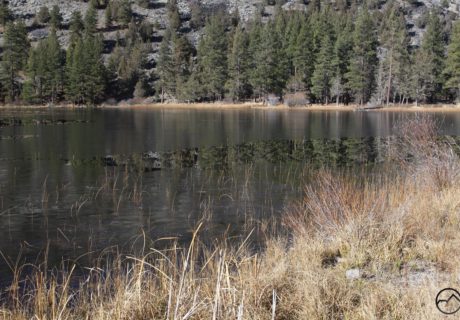
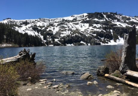
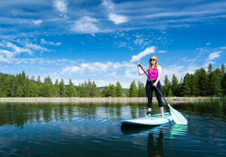
Castle Lake is a 47 acre glacial lake located high in the Eddy Mountains west of Mt. Shasta, perfect for fishing, paddleboarding, kayaking and skating.
Mt. Bradley Lookout is a moderate to difficult hike with two attractive lake destinations along the way – dramatic Heart Lake and pastoral Little Castle Lake.
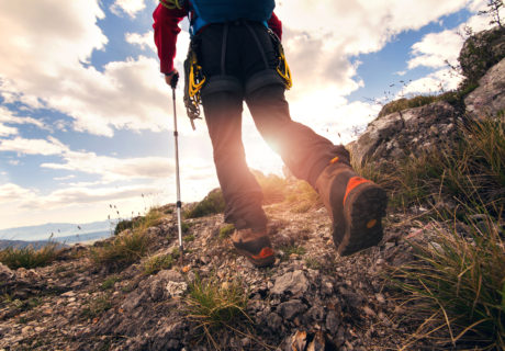
Remember that wilderness safety is your responsibility. It is important to realize you may not be able to rely on a cellphone for help and the wilderness has unforeseen risks […]
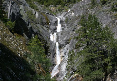
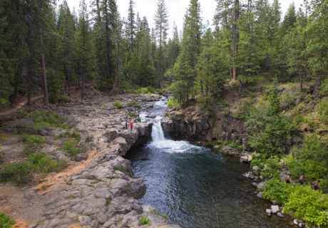
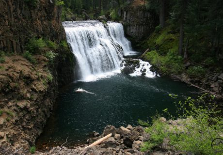
The McCloud River Falls Trail is a favorite in the area because it leads you to three waterfalls. These waterfalls have formed because the river has run into tough, erosion-resistant […]
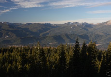
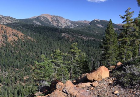
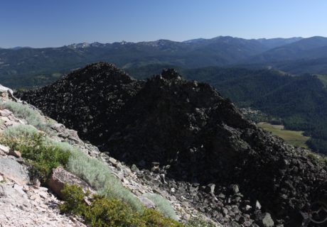
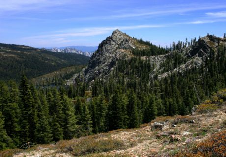
The Scott Mountains are one of the least known mountain ranges, but most beautiful in the Mount Shasta area. There are rugged peaks, scenic geology and many lakes an meadows. The […]
Following East Boulder Creek, the East Boulder Lake Loop takes you through a wide shallow canyon. Going through meadows the creek follows along. The route crosses the wilderness boundary into the Trinity Alps […]
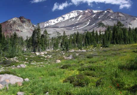
Panther Meadow Loop Trail gives great views of Mount Shasta. Spring water flows through alpine meadows full of wildflowers. Please stay on the trail due to fragile plants and do […]
Petroglyph Point Trail starts on the east side outside of Petroglyph Point. Across from the trail entrance you will see the trailhead parking lot where you will then hike to the top […]
Box Canyon, is an easy 1.5 mile trail with lots to offer and close to the Sacramento River. It offers many vistas down into the canyon, it is a nice relaxing […]
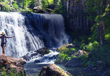
Ash Creek Falls is one of the finest falls in California. It is set far back in Ash Creek Canyon as the waterfall makes a huge scene, gushing over the […]
The Bunny Flat Trail is where snowmobilers can head into the Old Ski Bowl area, it accesses all routes for climbers and hikers on the south and west sides, and […]
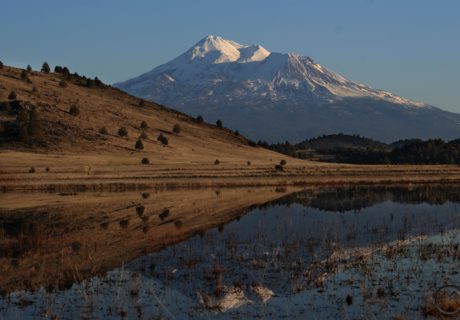
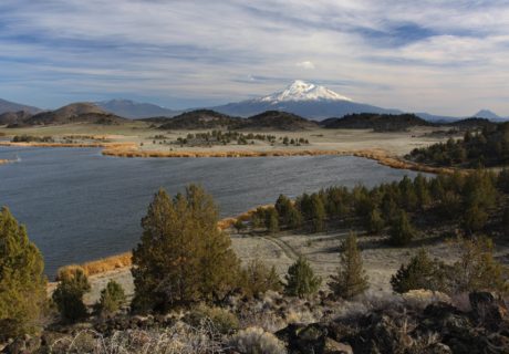
With majestic views of Mt. Shasta and typically still water, Lake Shastina is a great place for water recreation in Siskiyou, especially spring and summer.
A trailhead that no one goes on is called Sand Flat at 6,830 feet. Just before Bunny Flat you can access it off of the Everett Memorial Highway. Both the upper and […]
Pacific Crest Trail from Parks Creek Trailhead can be reached from a paved road about 30 miles from Mt. Shasta Ranger Station. Going south on the Pacific Crest Trail, there is level 2 […]
Castle Lake is located high in the Eddy Mountains west of Mt. Shasta. Photo Credit: Castle Lake TripAdvisor (ber57nie, sekharbvp, Craig S., Timothy Y.)
Pluto’s Cave was formed by an eruption of basaltic lava which came from a vent approx. 8 miles northeast between Deer Mountain and The Whaleback. Today it is a lava […]