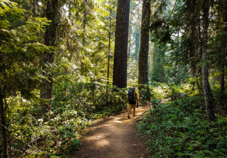
Explore new horizons in Siskiyou, where each season offers a fresh perspective.
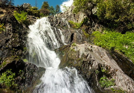
Ash Creek Falls is one of the finest falls in California. It is set far back in Ash Creek Canyon as the waterfall makes a huge scene, gushing over the […]
A moderate 15 mile mountain bike trail that provides three to five hours of riding time. Experience elevation gains and descends on this trail.
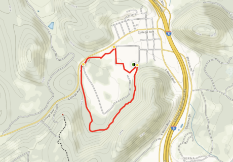
Bear Trail (College of the Siskiyous) is a 2.1 mile moderately trafficked loop trail located near Weed, California.
A 5.5 mile multi-use trail with views of the Klamath River, located just 2 miles south of Happy Camp.
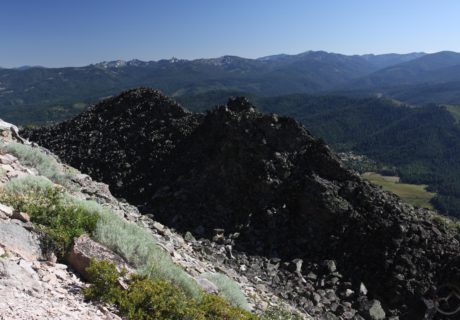
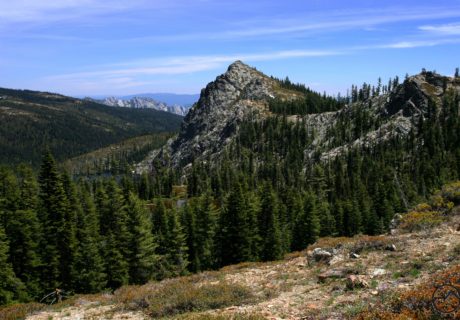
The trail winds its way around the north side of the pinnacle of Black Butte, revealing amazing views en route to a 360 degree vista at the summit.
Box Canyon, is an easy 1.5 mile trail with lots to offer and close to the Sacramento River. It offers many vistas down into the canyon, it is a nice relaxing […]
The Bunny Flat Trail is where snowmobilers can head into the Old Ski Bowl area, it accesses all routes for climbers and hikers on the south and west sides, and […]
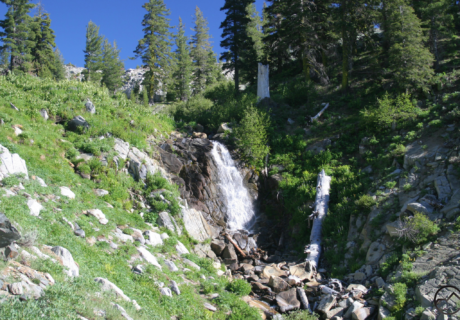
Burstarse Falls is actually a pair of beautiful waterfalls located in the Castle Crags Wilderness about a quarter mile off the PCT.
Along Captain Jack’s Stronghold Trail you can do one of two short self-guided interpretive trails that go through Modoc, wartime defenses. At Lava Beds National Monument in the Northern Sierra Cascade you can walk where Captain […]
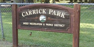
Carrick Park located off Highway 97 on Maple Street. This neighborhood park is a 3 acre green haven.
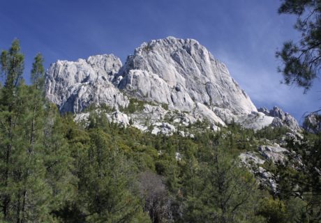
The Castle Crags are a very difficult area to see due to no trails going into the spire covered heart of granite making the viewing difficult. There are some trails […]
The Castle Dome Trail climbs through forested area before popping you out between Castle Dome and the Crag’s eastern face.
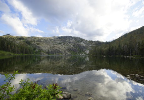
Castle Lake trail is one of the longer hikes in the greater Mount Shasta area encompassing 11 miles round trip, and is so worth it due to the amount of lakes and […]

A moderate 6 mile trail. Enjoy the views of Castle Crags, Mount Shasta, and an endless vista of range and valley.
“Castle Peak” lies between Castle Crags and the Trinity Divide and this is the location that has given the mountain its unofficial name at the edge of Crags as well […]
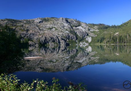
The Castle Lake Shore Trail begins through brush and rocks as it goes around a little part of the lake. The trailhead is at the north end of the parking […]
On the southwest face of Mount Shasta is where you will find Clear Creek, the main route. This route has an easier slope than Avalanche Gulch and has amazing views, […]
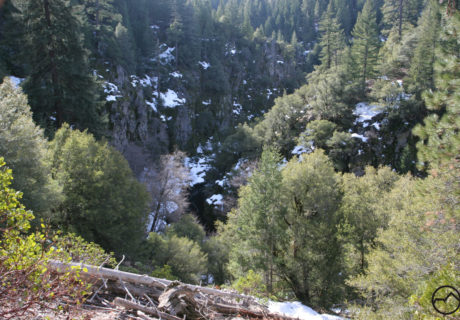
A rarely traveled trail that passes through lake basins, meadows and descends through a large canyon alongside the North Fork of the Sacramento River.
A long traverse of the lower section of the stunning Castle Crags on the Pacific Crest Trail.
For a little taste of waterfalls and wilderness, head to the aptly named Dog Trail in the Castle Crags Wilderness area.
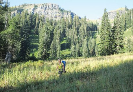
Following East Boulder Creek, the East Boulder Lake Loop takes you through a wide shallow canyon. Going through meadows the creek follows along. The route crosses the wilderness boundary into the Trinity Alps […]
Heading out to Etna Summit? Expect great views and cooler temperatures than the Scott Valley below.
This short hike enters a lush canyon, home to 19th century ruins a well-developed rock climbing area, a crashing creek and a beautiful waterfall.
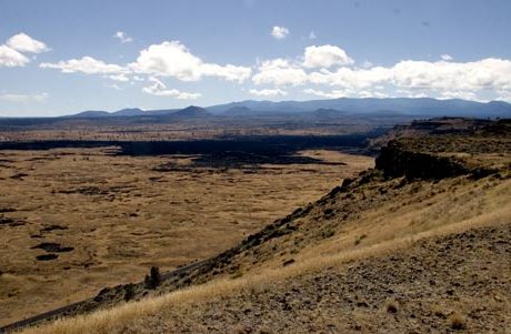
On the border of the Modoc National Forest and Lava Beds National Monument is the Gillem Bluff, a low elevation ridge sitting between 4400 feet and 4600 feet in elevation. There are no trails on this part of the […]
Near Tulelake, California is Glass Mountain which is a 4.9 mile round trip trail with moderate traffic. Glass Mountain offers beautiful views and mostly used for hiking, walking, nature trips, and birding which is […]
Up the side of the Goosenest is the Goosenest Trail. It is a short but very steep hike up the side of a volcano with a large crater. It is an outstanding view of […]
Gray Butte Trail is a moderate 3.5 mile round trip out of Panther Meadows that passes a sacred Native American site and old-growth forest on the way to an expansive […]
A mile hike uphill to a lookout that’s complete with a picnic table and a beautiful view of Happy Camp.
There is a volcanic dome called Haystack in the California, Shasta Valley. The valley is a lot less traveled as people just want to get to the high country and pass through. Many people […]
The Trinity Divide, Heart Lake Trail is short and offers great view. The amount of alpine terrain and vistas is hard to come by. It starts at the Castle Lake […]
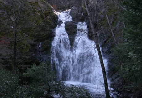
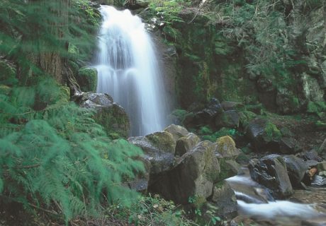
North of Redding in Dunsmuir there is a waterfall called the Hedge Creeks Falls. Hedge Creek runs off into the Sacramento River and is very popular due to its close proximity to I-5 making it a ideal stopping […]
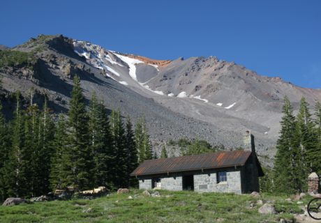
Driving to Bunny Flat is still easy, despite the closing of the Everett Memorial Highway. You can hike the Green Butte Ridge Trail or the path to Horse Camp. Right now […]
You can get to Horsetail falls by car to admire the marble-white cascade and see a much smaller cascade a half a mile north, Ponytail Falls. If you want to […]
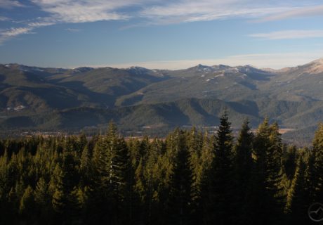
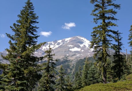
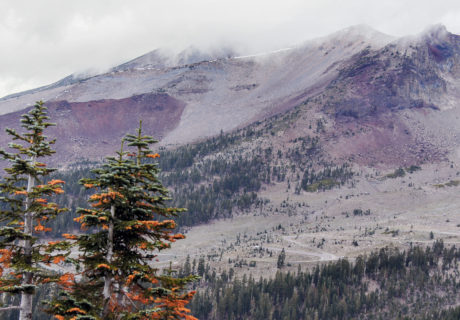
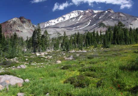
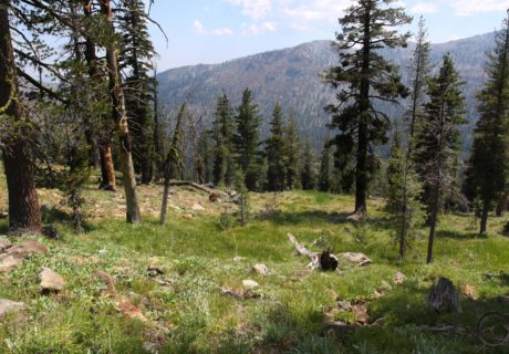
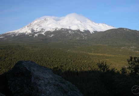
Bask in the views of surrounding mountains while hiking on Mount Shasta. The far-reaching panoramas are abundant along every trail on the mountain.
Just west of the Scott River on Kelsey Creek you pick up the Kelsey National Recreation Trail. Today the trail serves as a popular day hike to Paradise Lake and […]
Klamath National Forest is a 1,737,774-acre (2,715 sq mi; 7,033 km2) national forest, in the Klamath Mountains, located in Siskiyou County in northern California,

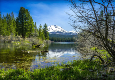
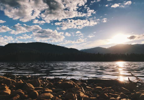
With majestic views of Mt. Shasta and typically still water, Lake Shastina is a great place for water recreation in Siskiyou, especially spring and summer.

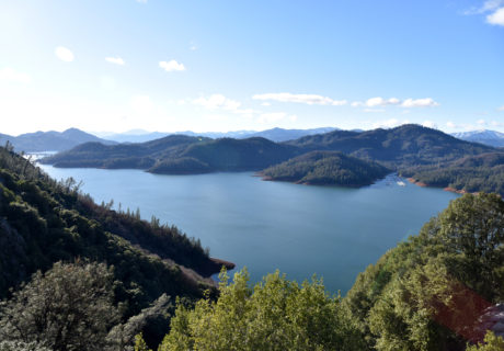
Lake Siskiyou is located in Northern California at the foot of the Trinity Divide. It has amazing views of Mount Shasta and is not far from the city that boasts many outdoor activities. Swimming, non-motor […]
A good example of dry and wet high elevation meadows is the Little Shasta Meadow Botanical Special Interest Area that is 290 acres. Alongside the Forest Service road 46N09 about 1.6 miles […]
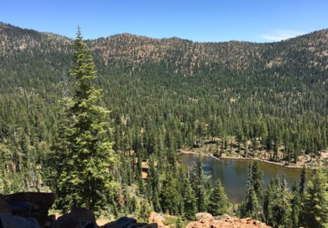
Eighty-nine lakes, magical meadows, and big streams are what encompass the Marble Mountain Wilderness. The wilderness is surrounded by a variety of trees, dominated by tanbark oak, madrone, and Douglas […]
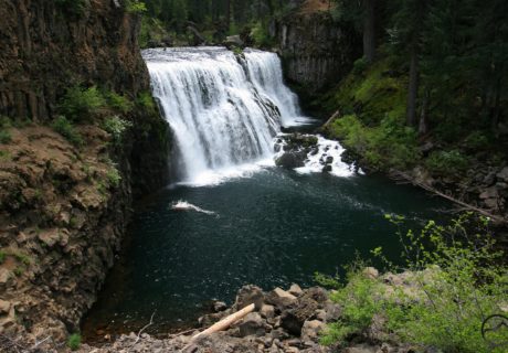
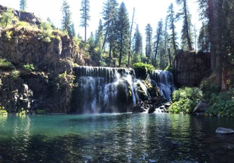
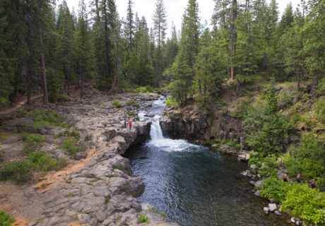
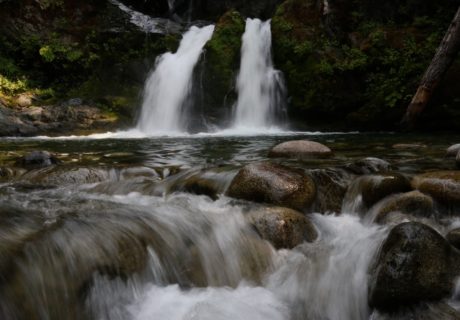
The McCloud River Falls Trail is a favorite in the area because it leads you to three waterfalls. These waterfalls have formed because the river has run into tough, erosion-resistant […]
The McCloud Area offers fishing, hunting, swimming, camping, hiking, photography opportunities, and breathtaking scenery. As suspected, during the winter months, snowmobiling, cross-country skiing, hunting, fishing, and skiing are the main […]
The McCloud River flows east of and parallel to the upper Sacramento River, in Siskiyou County and Shasta County in Northern California.
Medicine Lake sits in the caldera of an ancient volcano and is 30 miles Northeast of Mount Shasta. The last time that the Medicine Lake Volcano erupted was nearly 1,000 […]
The development of a broad shield volcano formed the Medicine Lake Highlands. When the center block happened to fall along the fractured lines it created an enclosed basin 6 miles […]
The Modoc National Forest is a 1,654,392-acre (6,695 km2) national forest in northeastern California.
Mt. Bradley Lookout is a moderate to difficult hike with two attractive lake destinations along the way – dramatic Heart Lake and pastoral Little Castle Lake.
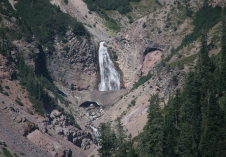
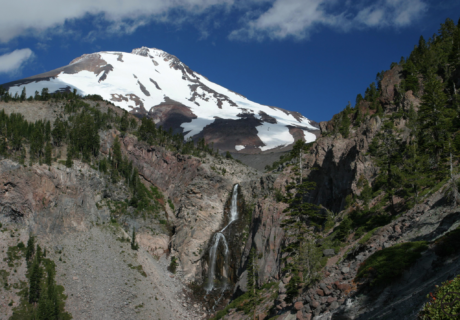
One of the most beautiful waterfalls in California is the Mud Creek Falls. It has the highest volume by far of any of the other falls on Mt. Shasta from […]
Mount Shasta Ski Bowl opened in 1958 and in 1978 an avalanche took out the lifts leaving it no longer operating, but it is still an amazing place to visit. […]
Pacific Crest Trail from Parks Creek Trailhead can be reached from a paved road about 30 miles from Mt. Shasta Ranger Station. Going south on the Pacific Crest Trail, there is level 2 […]
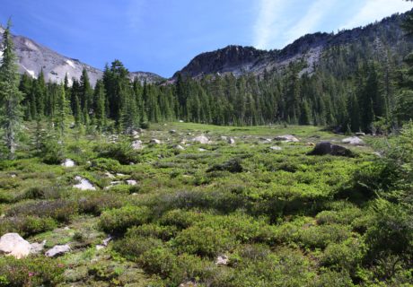
Panther Meadow Loop Trail gives great views of Mount Shasta. Spring water flows through alpine meadows full of wildflowers. Please stay on the trail due to fragile plants and do […]
A moderate 4.6 mile trail. Incredible views throughout. The route follows snow-covered Everett Memorial Highway to its terminus at the Old Ski Bowl.
Petroglyph Point Trail starts on the east side outside of Petroglyph Point. Across from the trail entrance you will see the trailhead parking lot where you will then hike to the top […]

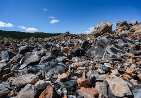
Pluto’s Cave was formed by an eruption of basaltic lava which came from a vent approx. 8 miles northeast between Deer Mountain and The Whaleback. Today it is a lava […]
River Park, in Happy Camp provides a scenic city park with green grass, a shaded pavilion and handy access to the refreshing Klamath River.
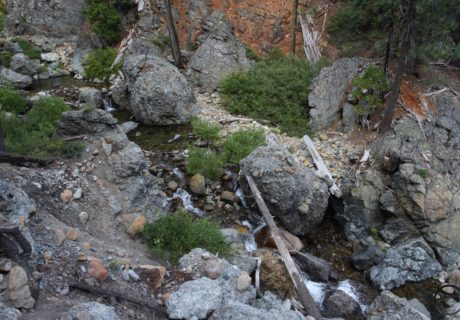
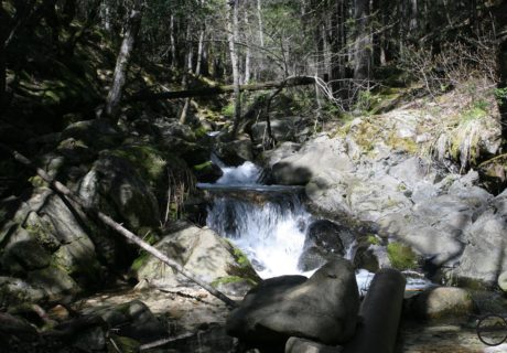
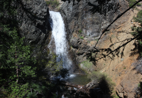
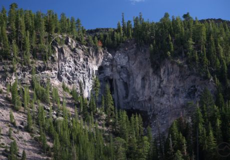
Root Creek Falls is a large, multi-tiered waterfall that spills 500+ feet over the granite Castle Dome just south of Dunsmuir in the Castle Crags wilderness area.
Remember that wilderness safety is your responsibility. It is important to realize you may not be able to rely on a cellphone for help and the wilderness has unforeseen risks […]

SWS Mountain Guides is a mountaineering guide service in Mt. Shasta, Ca.
To get to the trailhead the “upper” and “lower” Sand Flat Road can be used. The same routes can be accessed as the Bunny Flat trailhead using the Sand Flat […]
A trailhead that no one goes on is called Sand Flat at 6,830 feet. Just before Bunny Flat you can access it off of the Everett Memorial Highway. Both the upper and […]
A great hike up a cinder cone volcano that offers views of the surrounding wilderness. A hike to the Schonchin Butte Fire Lookout is worth the effort!
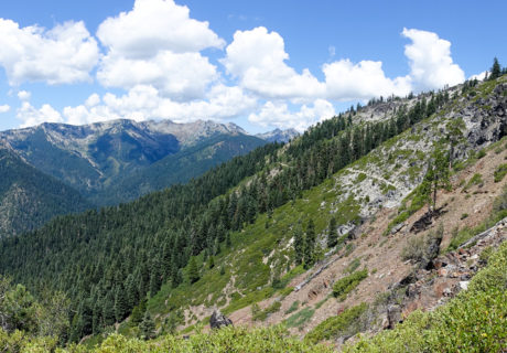
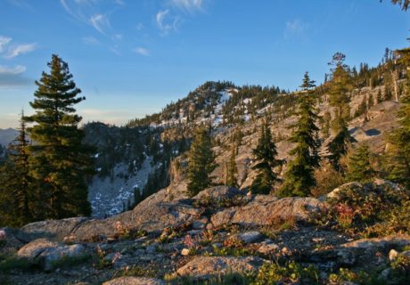
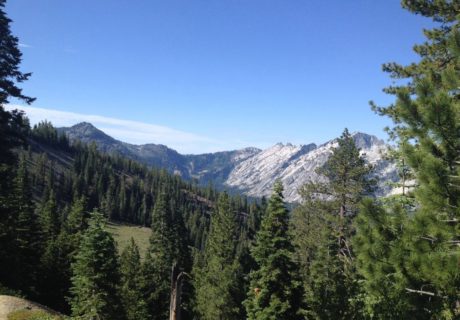
The Scott Mountains are one of the least known mountain ranges, but most beautiful in the Mount Shasta area. There are rugged peaks, scenic geology and many lakes an meadows. The […]
Expert-guided mushroom hunting adventures in the Mt Shasta region! Shasta Forage is a mushroom tour adventure business based in Mt. […]
Shasta Mountain Guides is the original climbing guide service on Mt. Shasta and leads the highest quality trips and expeditions on the mountain. For over 40 years we have shared […]
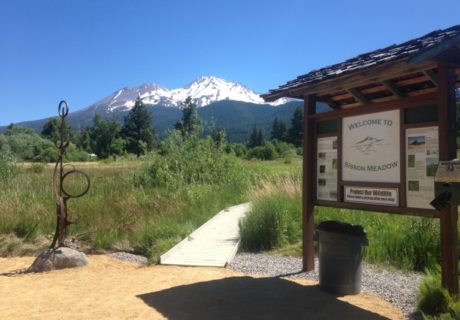
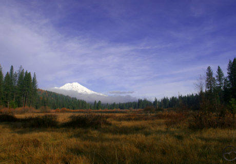
Sisson Meadow finds many people enjoying the views and nature of this wetland. It is a 7.5 acre beautiful well-known spot in Mt. Shasta. The land got purchased in 2003 and since […]
The Sisson-Callahan National Recreation Trail is a multi-use trail that follows the scenic North Fork of the Sacramento River for 3.3 miles.
Start at the Soda Creek Trailhead for a pleasant walk on the PCT in the woods leading to Root Creek […]
The most interesting trail on Mount Shasta is the Squaw/South Gate Meadow Trail. There are not many developed trails on the mountain which is surprising based off of the size. Most trails follow old […]
A 3 mile trail up Spring Hill at the north end of Mount Shasta City. Vistas offer views of the Trinity Divide, Strawberry Valley and Mount Shasta.
What Sweetbriar Falls lacks in size, it makes up for in ease of access and steady flow.
Two towns in California, Burney and McCloud, will be linked by the Great Shasta Rail Trail when done, along an 80-mile scenic trail. Along this trail the culture, local heritage, nature and the […]
In the Trinity Alps Wilderness there are approximately 550 miles of trails around. A lot needs to be maintained, but the maintenance also varies on the patterns of the trails, wilderness preservation […]
There is a short, but great hike in Shasta Valley to take you to Trout Lake. It has stellar views all around and highlights the high desert scenery.
Ukonom Creek is a cold, clear creek that feeds the Klamath River, and was named after a Karok chief.
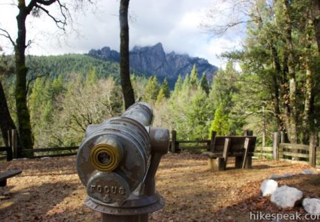
A popular destination for visitors to Castle Crags State Park is the scenic overlook at the end of Vista Point Trail.
If you want a nice well traveled trail to walk on check out the Lake Siskiyou Trail. It is great for residents of Siskiyou County and visitors. It goes through deep forests, meadows and […]
One of the least known waterfalls in the Mount Shasta area is Wagon Creek Falls. It is not thought about much, it gets lost amongst all the other beautiful waterfalls. […]
The Whitney Falls Trail is a hiking trail that leads to an overlook of Whitney Falls. There are four waterfalls on Mount Shasta, this being one. The Whitney Falls Trail […]

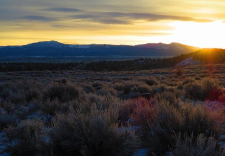
🌾 Siskiyou`s Scott Valley unfolds like a patchwork quilt of golden fields, winding rivers, and quiet mountain charm. Nestled between the Marble and Trinity Mountains, it’s one of Siskiyou’s best-kept secrets—peaceful, picturesque, and full of small-town heart. 💛
Whether you`re flying high or driving slow, this picturesque valley is worth the detour.
📸: @beanemedia
#DiscoverSiskiyou #ScottValleyViews #fortjones #HiddenGemsOfCalifornia #SmallTownCharm #NorthernCaliforniaBeauty #naturefromabove

🎈 Up, up, and away in Montague!
Join us for the annual @montagueballoonfair , where the skies come alive with color and wonder. Watch the balloons lift off against the stunning Siskiyou sunrise, enjoy family-friendly fun, and experience one of the most magical weekends in the region.
📍 Montague Airport
📅 Sept. 19-21, 2025
🌄 www.montagueballoonfair.com
#MontagueBalloonFair #DiscoverSiskiyou #SiskiyouSkies #UpUpAndAway #HotAirBalloonFestival #VisitSiskiyou #FallInSiskiyou #BalloonMagic #NorCalEvents #FamilyFun #ScenicSiskiyou
✨ The stars shine brighter in Siskiyou.
With low light pollution and wide-open skies, our region offers some of the best stargazing in California. Bring a blanket, look up, and lose yourself in the magic of the cosmos. 🌠
📸: @rockmaven56
#DiscoverSiskiyou #StargazeSiskiyou #AstroPhotography #NatureAfterDark #stargazing #california #LookUp
Labor Day Weekend = one last summer adventure. ☀️⛰️ From lakes to trails, Siskiyou’s the place to savor every mom#peaceofmind
📸: @etch_in_love
#discoversiskiyou #seesiskiyou #mtshasta #lakesiskiyou #MountainLife #california #labordayweekend #peace
Still soaking up summer? Us too. 😎 But trust us—fall in Siskiyou is worth planning ahead for. Golden trails, cozy nights, and mountain views are waiting. Link in bio for our top five spots to find fall color in Siskiyou 🏔️🍁
📸: @kiwibandit
#DiscoverSiskiyou #VisitCalifornia #ExploreCalifornia #NorCalAdventures #NorthernCalifornia #CaliforniaFall #FallGetaway #AdventureAwaits #HiddenCalifornia #SiskiyouCounty #FallInCalifornia #MountainEscape #WanderNorCal #AutumnAdventures
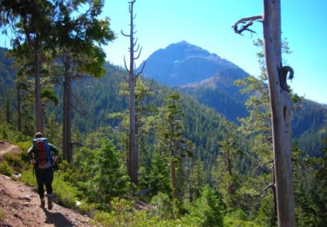
Trail to the sky. ⛰️✨ Hiking Castle Crags State Park means big views, fresh air, and feeling on top of the world.
📸: @morgan_swartz
#DiscoverSiskiyou #CastleCrags #ExploreCalifornia #VisitNorCal #AdventureAwaits #GetOutside #SiskiyouCounty #HiddenCalifornia #NorCalHikes #ForestEscape #CaliforniaMountains #TrailViews #WildCalifornia
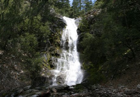
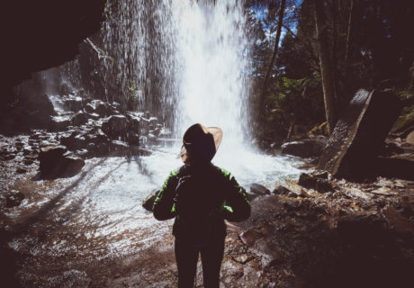
🌿 Tucked just off the highway in Dunsmuir lies a little slice of magic — Hedge Creek Falls! This easy walk leads to a waterfall you can literally walk behind, with mist on your face and views of Mt. Shasta peeking through the trees. A perfect quick stop that feels like a secret. 💦✨
📸: @backroadsculture
#DiscoverSiskiyou #HedgeCreekFalls #DunsmuirCA #WaterfallWednesday #HiddenGems #NorCalNature #VisitSiskiyou
Happy Fourth of July! 🎆
Whether you’re chasing waterfalls, hiking under the stars, kayaking on crystal-clear lakes, or enjoying a local festival—Siskiyou is the perfect place to make holiday memories.
🎇 Please remember to recreate responsibly - do not light your own fireworks, and pack out all of your trash! Tag us in your weekend fun using #DiscoverSiskiyou and stay safe out there! 🗻🌲💥
📸: @livelikeitsthewknd
#discoversiskiyou #seesiskiiyou #visitcalifornia #norcal #california #adventure #pnw #chasingwaterfalls #granolagirls #mtshasta
🌋✨ Exploring @lavabedsnps is like stepping onto another planet! From epic lava tube caves to ancient petroglyphs, every corner tells a story millions of years in the making. 🖖🏞️
If you’re craving adventure and a place that’s totally off the beaten path, this is it. Bring a flashlight, good shoes, and a spirit for exploration! 🥾🗺️
#LavaBeds #SiskiyouAdventures #NatureIsMagic #ExploreCalifornia #CaveExploring #seesiskiyou #discoversiskiyou #visitcalifornia #california #caves #geology #norcal
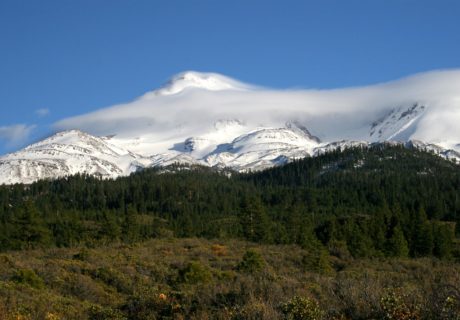
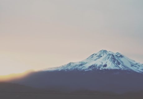
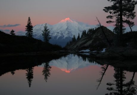
Chasing light, finding peace. 🌄✨
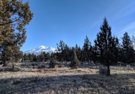
Mt. Shasta glowing in the golden hour—nature really showing off.
📸: @happylustig
#MtShasta #SunsetVibes #NatureHeals #WanderMore #discoversiskiyou #seesiskiyou #california #norcal
We dare you to drive over Forest Mountain into Scott Valley without stopping to snap a photo 🌲🏔️✨
📸: @tcoelhophotography
#discoversiskiyou #seeiskiyou #scottvalley #mountainviews #pnw #roadtrip
Siskiyou has some of the darkest skies on the West Coast, making it the ultimate location for stargazing ✨🪐 🌙 Check out our suggestions for the best spots around to view the cosmos at the link in our bio!
📸: @roadtripreadymedia
#discoversiskiyou #seesiskiyou #norcal #visitcalifornia #norcal #darkskies #stargazing #nightsky #milkyway #astrophotography
Sunday`s full "snow moon" casting its silver glow over the Siskiyou mountains—nature`s masterpiece in the sky. 🌕
📸: @optimal_focus
#FullMoon #snowmoon #siskiyou #discoversiskiyou #california #norcal #pnw #naturephotos
Tulelake National Wildlife Refuge: where every corner is alive with the sounds and sights of nature 🦅✨ From majestic bald eagles to waterfowl, raptors, and big game, this gem located in East Siskiyou is a paradise for nature lovers. Link in bio for details!
#TulelakeRefuge #Birdwatching #WildlifeWonders #NatureInFocus #FeatheredFriends #discoversiskiyou #siskiyoucounty #norcal #pnw #mtshasta #shasta #landscapephotography
Snow is coming! Be ready for it - purchase your @mtshastanordic season pass today! Get yours online at mtshastanordic.org
#discoversiskiyou #northerncalifornia #seesiskiyou #concert #visitcalifornia #visitca #siskiyou #siskiyoucounty #mtshasta #snowshoe #crosscountry #skiseason


